Shipping has always been an essential activity in the
Åland Islands (population 28000), an autonomous, monolingually Swedish-speaking region of
Finland, situated between
Sweden and the
Finnish mainland. A look at the map (from 1910) above makes it easy to understand that navigating among the altogether over 6700 islands and skerries is not easy. That is why there were already in the beginning of the 20th century several
lighthouses and lightships in the Åland waters, as the map below (also from 1910) shows.
 |
| The position of the lightship Storbrotten, which was operating between the years 1908-1922, can be seen in the northwestern part of the Åland Islands. |
 |
Storbrotten (34,1x7,6m) was destroyed by a mine and was later replaced by a bigger lightship with the same name. Finally the ship was replaced by a light buoy in 1958.
|
 |
The lighthouse Märket, located in the middle of the Åland Sea, was inaugurated in 1885. Märket became unmanned in 1976.
Gisslan, an unmanned lighthouse south of Märket |
 |
| The Bogskär lighthouse, in the southernmost corner of Finland, was badly damaged by the Germans in 1915. After the first world war it was converted to an automatic acetylene-operated lighthouse . |
 |
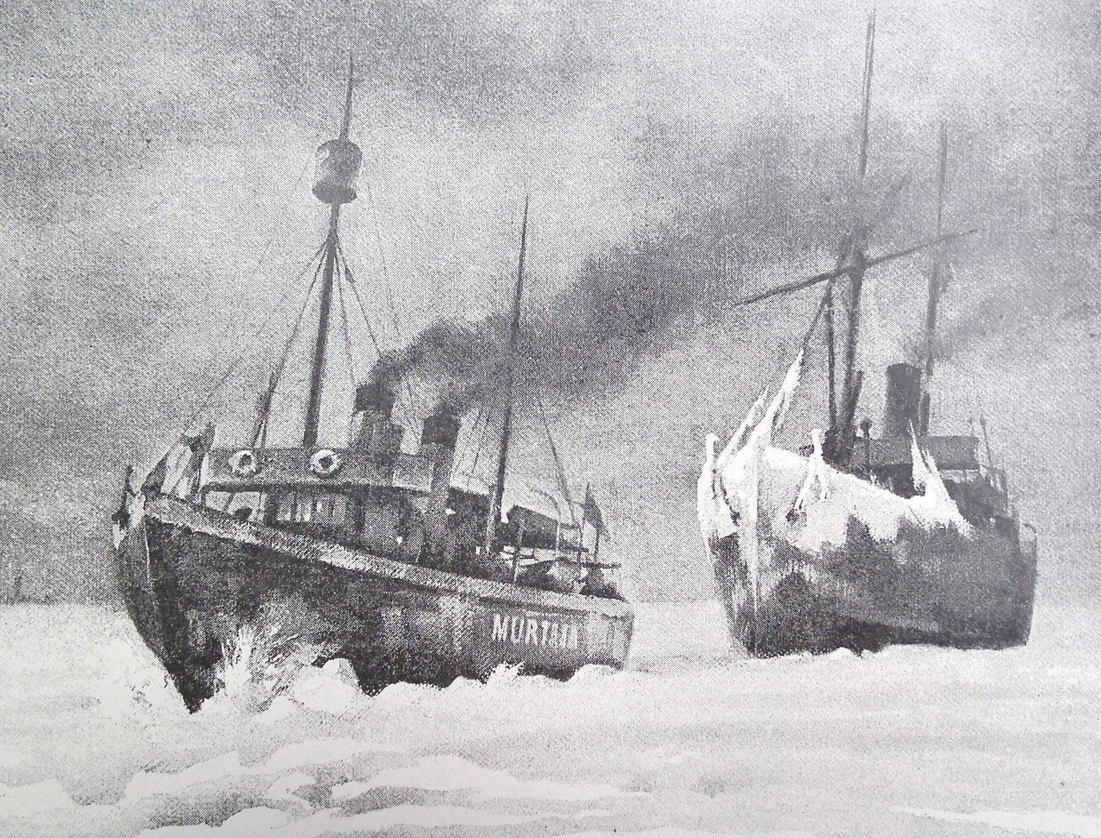
During the winter months icebreaker asssistance was often needed - as it still is today. Murtaja, Finland´s first icebreaker, was described as "the newest, biggest and strongest icebreaker in Europe", when it arrived from Sweden on April 1, 1890.
Work on a commercial sailing ship was often hard, but the crews of these two Åland galeases must have enjoyed this beautiful summer evening in the archipelago. In the year 1908 268 of Finland´s altogether 383 ships in the merchant fleet were still sailing vessels.
A view from Mariehamn´s Western harbour |
(More information about the maritime history of the Åland Islands in a previous post here.)


No comments:
Post a Comment