
Saturday, 5 October 2013
Tanker Iver Progress in Øresund
Last night the tanker Iver Progress (184 m x 27 m) was going southwards in the Sound. The ship's destination is Primorsk:


Friday, 4 October 2013
Reefer Baltic Strait and tanker Oljaren passing Kronborg
The reefer Baltic Strait (146 m x 25 m) and the small oil product tanker Oljaren (56 m x 9 m) tonight passed Kronborg castle on their way northwards in the Sound:
 |
| The Baltic Strait approaching Kronborg. |
 |
| The Baltic Strait's destination is Flushing. |
 |
| Tanker Oljaren on its way to Gothenburg. |
 |
| Oljaren and Kronborg. |
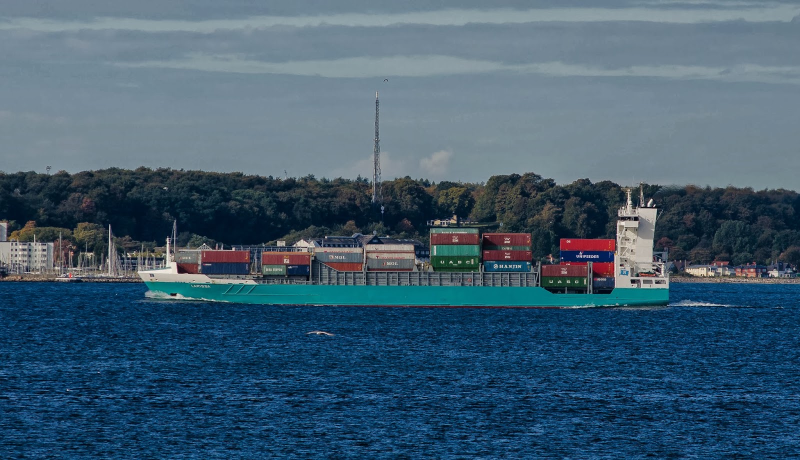
Container ship Larissa approaching Helsingør
This is the Cyprus registered container ship Larissa (134 m x 23 m) approaching Helsingør on Monday. Larissa was then going to Swinoujscie. Right now the ship is on its way to Bremerhaven:


Rooftops of Elsinore
The rooftops of Elsinore (Helsingør) are nicely "medieval":

PS
I added another image, just for comparison:

The Swedish Geological Survey's research/survey ship Ocean Ranger in Helsingborg

This is the Swedish Geological Survey's research/survey vessel Ocean Ranger, moored in Helsingborg on September 30. The SGU uses the 38 m x 12 m catamaran for mapping the seabed:
In order to meet the need for marine geological information, SGU is surveying and mapping the seabed in Sweden’s territorial waters and exclusive economic zone (EEZ). The information thus produced is used in local and regional spatial planning etc., in the planning of marine construction projects, as data for the fishing industry, for military surveillance, and environmental monitoring. The users include individual fishermen, local, regional and national authorities, industry, and the Armed Forces.
To map the seabed, SGU uses a specially equipped survey vessel, Ocean Surveyor, and a small boat for use in shallow waters. To obtain data concerning seabed composition and appearance, various hydroacoustic systems are used, e.g. echo sounders, seismics and side scan sonar. Gravity corers and piston corers are used to take sediment samples. Underwater video cameras are also used.
Thursday, 3 October 2013
Two Japanese peace delegates in Portsmouth, New Hampshire, in 1905
The defeat in the 1904 - 1905 Russo-Japanese War was a major blow to Imperial Russia. Tsar Nicholas II chose a negotiated peace, brokered by American President Theodore Roosevelt (which earned him the Nobel Peace Prize). The Treaty of Portsmouth was signed on 5 September 1905 at the Portsmouth Naval Shipyard, New Hampshire.
The Japanese delegation at Portsmouth was led by Foreign Minister, Baron (later Marquis) Komura Jutarō - a Harvard graduate -, assisted by another Japanese nobleman, Baron Takahira.
The Japanese delegation at Portsmouth was led by Foreign Minister, Baron (later Marquis) Komura Jutarō - a Harvard graduate -, assisted by another Japanese nobleman, Baron Takahira.
 |
| The Japanese peace delegates, Baron Komura (on the right) and Baron Takahira on board President Roosevelt's yacht Mayflower. Komura is said to have inherited massive debts from his father, which he had difficulties with repayment. As a result, he wore the same frayed coat for years, regardless of season or occasion. Whether the coat on this photo is the frayed one, is difficult to tell. |
The fight aganist "King Alcohol" in Berlin 1905
Heavy drinking is a major problem in many European countries - as it was already in the beginning of the 20th century. This photo from 1905 shows members of the newly founded Salvation Army brigade in Berlin ready for action:

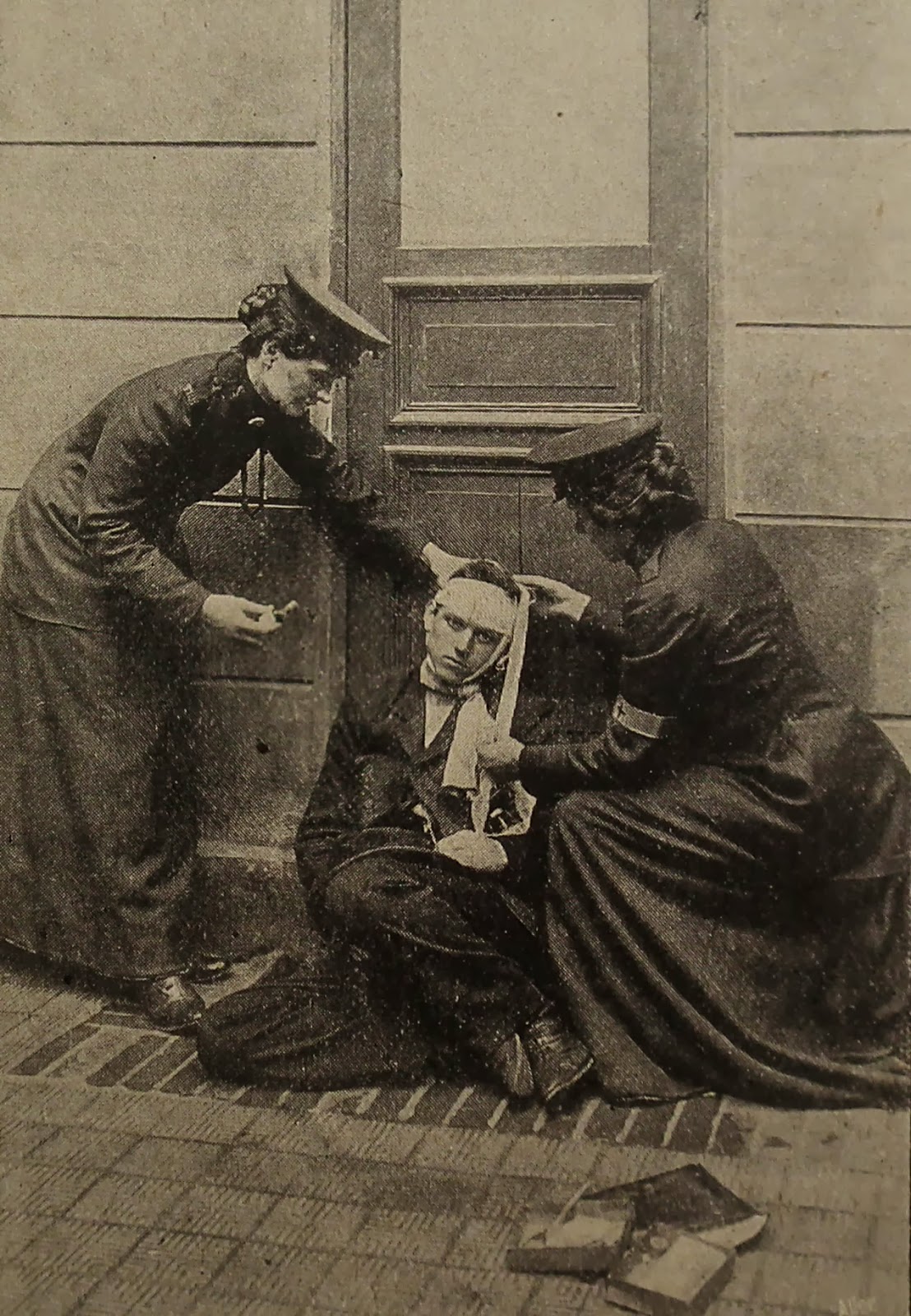
Two Salvation Army members taking care of a drunkard in Berlin in 1905:


Two Salvation Army members taking care of a drunkard in Berlin in 1905:
Subscribe to:
Posts (Atom)